Home
Research
Publications
Talks
Conferences
Contact
Posts
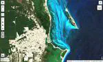
Digital Image Processing for Remote Sensing
This class is a general introduction to Digital Image Processing, with special focus on remote sensing applications using Google Earth Engine (GEE) and its Python API. It was taught at UNAM in 2024, as part of the Licenciatura en Geografía Aplicada in the Escuela Nacional de Ciencias de la Tierra (ENCIT).
Dennis Wörthmüller
Last updated on May 29, 2024
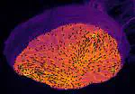
Computer Vision for Geosciences: from classical methods to modern approaches using Deep Learning
This class is a general introduction to Computer Vision methods relevant in geosciences. It teaches both classical and machine learning based techniques. It was first taught at UNAM in 2021, and an updated version of the course is currently being taught (2024).
Dennis Wörthmüller
,
Manuel Wöllhaf
Last updated on Jun 4, 2021
Cite
×